The Army of Islam — one of the most prominent Syrian rebel factions — published a documentary film explaining the facts and events of the battle of “Allah Ghalib” (God is Victor), in which the group was able to enter the reserve military leadership and security branch in the suburb of Harasta, overlooking the Damascus-Homs international highway last September.
According to the film, the biggest achievements of the battle were: “Stopping the terrible military campaign waged by regime forces supported by the Hezbollah militia on the town of Zabadani, and obtaining top secret documents criticizing the regime’s security forces, which will be published successively by the Army of Islam, including documents of the intelligence agencies and military security, and withdrawal of the full archives of the military leadership.”
The Army of Islam noted in its film that in the battle it was able to derail a major military plan — purportedly the largest of its kind — in which the regime was preparing to enter Eastern Ghouta from multiple directions. It indicated the regime forces were on the brink of collapse in Harasta and its communications would have been cut with Damascus if not for the Russian air intervention.
The film states that during the battle the Army of Islam took control of a number of heavy vehicles, equipment, and anti-armor weapons, such as the “Konkurs, Milan and Red Arrow.” It noted that the Army’s fighters repelled 223 attempts by the regime to break into the mountain ranges, killing over 700 fighters from various militias and taking 70 regime fighters prisoner.
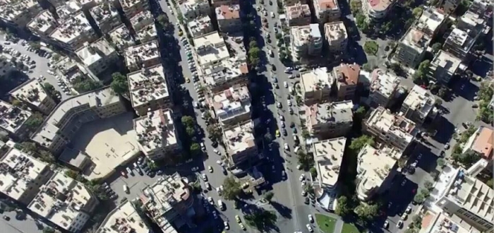
In addition to the strategic importance of the battle, which lasted nearly two months, the end of the video carried aerial photos of several places in the Syrian capital Damascus, taken by a drone of the Army of Islam’s “Monitoring and Tracking Unit”.
The images depicted the Umayyad Mosque, Souq al-Hamidiya, Abbasid Square, al-Adawi Highway — controlled in its entirety by regime forces — and other sites inside Eastern Ghouta, like the Grand Mosque in Douma, Souq al-Baladiya and the Jobar district, indicating the amount of damage resulting from continuous regime bombardment for over three years.
Abu Hadi, head of the reconnaissance aircraft division in the Army of Islam, said in comments to Al-Souria Net that “with the development of military activity, we had to pursue more effective methods and systems that were not expected by the forces of Assad’s regime. We succeeded in bringing unmanned aircraft into our war with Assad, which enabled us to monitor the regime’s positions from the air.”
He added: “We used the aircraft in the battles of al-Qaboun, Jobar and others. The preparation process doesn’t require great effort, and all battles are prepared for with reconnaissance aircraft,” saying that the positions of Assad’s forces are now monitored by Army of Islam reconnaissance.
Abu Hadi said that the work of these aircraft is not limited to reconnaissance, but supply Army of Islam artillery with the coordinates of centers and targets of Assad’s forces through monitoring and photography.
This type of aircraft was used for the first time in the Vietnam War. The Lebanese militia Hezbollah also has a similar aircraft (the Ayoub), which is of Iranian manufacture, assembled on Lebanese territory. They were also used by the Islamic State group, which probably obtained them from the barracks of the Iraqi army, in photographing and monitoring the Brigade 93 and the Tabqa military airbase in Raqqa.
This article was translated and edited by The Syrian Observer. Responsibility for the information and views set out in this article lies entirely with the author.